Cyclone Mocha may intensify into severe storm by May 12, says IMD
Cyclone Mocha forming over the Bay of Bengal may intensify into a very severe storm by Friday when wind speeds can reach 130 kmph, the India Meteorological Department warned on Monday, saying that details of its landfall could be available by Tuesday.
A low pressure area formed over south-east Bay of Bengal and adjoining South Andaman Sea on Monday, the weather bureau said. It is likely to intensify into a depression on May 9 and into Cyclone Mocha on May 10. The storm is expected to move towards the Bangladesh and Myanmar coasts around May 12.
Small seafaring vessels and fishers were warned not to venture out from Tuesday. The Met department also asked authorities to regulate tourism, offshore activities and shipping near the Andaman and Nicobar Islands between May 8 and 12.
An atmospheric trough was running from south-west Bay of Bengal off north Tamil Nadu coast to cyclonic circulation associated with the low-pressure area over south-east Bay of Bengal and adjoining south Andaman Sea, the weather office said in its bulletin. A western disturbance as a cyclonic circulation is also lying over north Pakistan and adjoining Jammu and Kashmir in middle tropospheric levels, it said.
“The time of landfall (and) expected intensity as it moves towards the coast will be available when the low pressure area intensifies into a depression,” said M Mohapatra, director general of the Met office. “We have issued a subjective statement for now, but the specifics will be made available soon as the models provide a clearer picture within a five-day forecast period.”
“Both ocean and atmospheric conditions over the Bay of Bengal are favourable for cyclone development. The ocean surface temperatures are anomalously warm by 1-2 degrees Celsius and the subsurface heat is also sufficient to provide a constant supply of heat and moisture for cyclone formation and intensification,” said Roxy Mathew Koll, climate scientist at Indian Institute of Tropical Meteorology, Pune.
“Even though we do not yet have forecasts for a severe cyclone, we should keep a watch and be prepared for potential cyclone intensification,” Koll said.
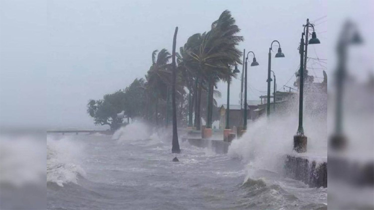
Rainfall is expected to increase over the Andaman and Nicobar Islands. Squally weather with wind speeds reaching 40-50 kmph gusting to 60 kmph is likely over south-east Bay of Bengal, Andaman and Nicobar Islands and adjoining Andaman Sea on Tuesday. Stormy condition are likely to continue at least till May 11.
Seas are likely to be very rough in the Bay of Bengal and Andaman Sea from May 10 till the end of the week. Waves could reach a height of as much as six to 14 metres, the Met office said.
The heat potential that provides energy to a cyclone is optimum over South Andaman Sea and adjoining south-east and central Bay of Bengal. The temperature on the sea surface is around 30 to 32 degrees over the Bay of Bengal, which is conducive for a cyclonic formation, the Regional Specialised Meteorological Centre said.
Comments are closed.